|
SPI, A TREASURY OF SLOVAKIA
http://www.spis.sk/en.html |

SPI, A TREASURY OF SLOVAKIA, is from a certain point of
view very similar to Switzerland. The Spi county could be
compared to a Swiss canton. It has its own self-government and a
peculiar culture. Every county developed independently from the
others. It had its own dialect, folk-dress and verbal
communication. People living in different counties had different
characters and cultural habits. Every county is unique and
non-repetitive. Spi belongs to counties that are rich on
natural beauties, educated labour-force and attractive cultural
monuments.
The Spi region has been endowed by a really beautiful nature.
Its northern part is surrounded by massive mysterious peaks of
the High
Tatras mountains, that merge with the Belianske
Tatras and the unique scenery of the National
Park Pieniny with the Dunajec
river. The eastern border ends at the LevočskÕ
vrchy (Levoča Mountains) represented by the Branisko
mountain. In the south, there is SlovenskÕ Rudohorie
mountain range followed by fantastic cliffs and gorges of the National
Park Slovak Paradise. Rivers that flow from the hills in the
west belong to the European watershed. The Spi rivers flow to
the north and east, while the rivers from the Liptov region flow
to the west. The rivers HornÃd
and Poprad
create something like a "backbone" of the Spi
region. What is interesting, the Poprad
river is the only Slovak river that flows to the north - and
merges into the Baltic Sea. They are rich on fishes and
therefore attract many fishermen. The High
Tatras attract mountain climbers, in winter skiers and a lot
of tourists as well. Having a very clear environment the High
Tatras are used for healing respiratory illnesses. This is
the reason why a number of sanatoriums and spas were built here.
Slovak
Paradise, Zamagurie
and Pieniny
mountains attract with its natural beauties lots of tourists and
lovers of nature. SlovenskÕ Rudohorie thanks to its rich
natural resources of copper, iron and precious metals gave jobs
to a large number of miners living in local towns and villages.
The huge spruce forests cover quite a large area of the Spi
region. They are an important source of foods and often visited
by tourists. Mountainy meadows and pastures are used for feeding
cattle and sheep, in winter for winter sports. In the Spi
region, you would find lots of springs of mineral water, such
as: Baldovce,
NovÃ
Ľubovňa (New Ľubovňa), Vrbov,
VynÕ Rubachy
etc. The thermal water in Vrbov
and in VynÕ
Rubachy is used for bathing and healing various illnesses.
The Spi region is a treasury of protected plants and animals,
which is proven by the fact that there are three National Parks:
High Tatras,
Slovak
Paradise and Pieniny
and several protected areas.
The Spi has always been a melting pot of many nations,
cultures and religions - in a positive way. From the very
beginning the Slovaks have always been a majority. The first
German colonists came in the 12. century. The have been awarded
royal privileges and successively founded a lot of independent
towns and villages with very lively trade. The Hungarians
settled down in the southern part in the 12. century, whereas
people speaking the polish dialect (sc. "gorals")
settled close to the current northern border. Russniaks and
Ukrainians settled usually in mountainy areas in the 14-th
century. They brought their own culture, language, but also
Eastern Christianity. Many Jews settled down in the Spi
region, too - especially in the village Huncovce.
The number of gypsies rose rapidly since the 15-th century. You
would find here people of the Roman-Catholic as well as the
Greek-Catholic religion, Orthodox, Evangelic and Jews. They
worked and lived together. This was the process how a
multiethnic culture arose. It has constantly been influenced by
a Central European culture and became its inevitable component.
The Spi region is also unusually rich on cultural and
historical monuments. You can find them almost in every village.
You do not need to go more than 100 km in order to find world
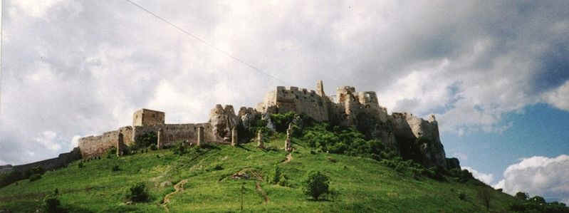
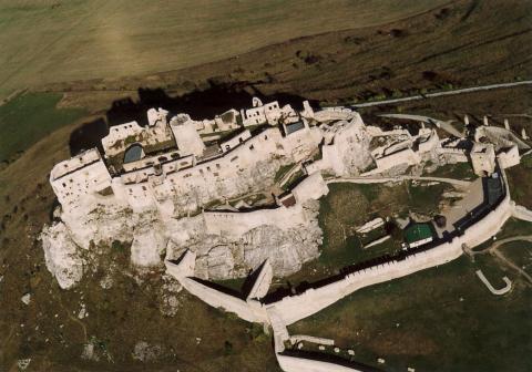
famous cultural monuments. The evidence is the fact that some of
them are a part of the world heritage acknowledged by the UNESCO
- such as Spisk»
hrad (Spi Castle), SpiskÃ
Kapitula, SpiskÕ
Podhradie, ehra
and DobinskÃ
ľadovà jaskyňa (Dobinskà Ice Cave). Plenty of
them are National Cultural Monuments - works of art from the Master
JÃn Pavol (John Paul) from Levoča, church
of the St. James in Levoča, the Spi
Castle, Evangelic Grammar school and a church in Kemarok,
museum in
Krompachy, a church in ehra
etc. Almost half of all the municipal cultural monuments in
Slovakia are situated in the Spi region - mainly in the town
of Levoča,
Kemarok,
SpiskÃ
Kapitula and SpiskÃ
Sobota. This is just a small part of all the gothic and
renaissance architecture, sculptures, wall and board paintings,
goldsmith's crafts and other arts as well.
Ethnical richness of the Spi culture influenced
heterogeneousness of its folk culture - regardless if we speak
about the folk architecture, dress, cultural habits, songs,
dances or crafts. All of this is harmonically combined with
material, spiritual culture and the surrounding beautiful
nature.
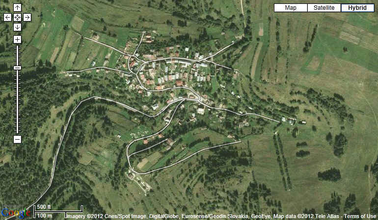
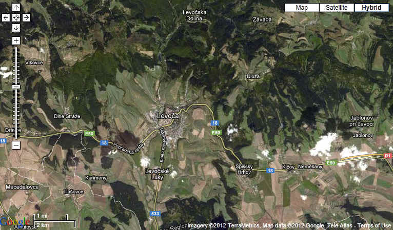
The most precious treasury in the Spi region is the town Levoča.
From the Middle Ages till the year 1922 it was an administrative
and cultural centre of Spi. It was one of the most important
royal towns in Ungarn. The town Kemarok
was the second most important. It kept its German character up
to the present day. Its German Evangelic Grammar School was the
most successful in the city. SpiskÃ
Kapitula was the spiritual centre of the Spi region. From
the 12. century it was a seat of the Spi clergy, today it is a
centre of the Spi bishop see. Gelnica
was a mining centre. Later the towns SpiskÃ
Novà Ves and Poprad
gained on importance. Very peculiar character and rich history
have the towns StarÃ
Ľubovňa, PodolÚnec,
SpiskÃ
Starà Ves, SpiskÕ
Vlachy and others. Some of them were given as a deposit to
the polish king and it took about 360 years till they were
returned.
|
|
Spi
Wikipedia, the free encyclopedia
http://en.wikipedia.org/wiki/Spi%C5%A1 |
Spi (Slovak;
Latin:
Scepusium, German:
Zips, Hungarian:
SzepessÕg, Polish:
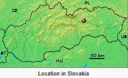
Spisz) is a region
in north-eastern Slovakia,
with a very small area in south-eastern Poland.
Spi is an informal designation of the territory (like Burgundy),
but it is also the name of one the 21 official tourism regions
of Slovakia. The region is not an administrative division in its
own right, but between the late 11th century and 1918 it was an
administrative county of the Kingdom
of Hungary, (see separate article Szepes
county).

Geography
The region is situated between the High
Tatras and the Dunajec
River in the north, the springs of the VÃh
River in the west, the SlovenskÕ
rudohorie Mountains (Slovak Ore Mountains) and Hnilec
River in the south, and a line running from the town of StarÃ
Ľubovňa, via the Branisko
mountain (under which lies the 4,822 m long Branisko
Tunnel, currently the longest in Slovakia), to the town of Margecany
in the east. The core of the Spi region is formed by the
basins of the rivers HornÃd
and Poprad,
and the High
Tatra Mountains. Throughout its history, the territory has
been characterized by a large percentage of forests - in the
late 19th century, as much as 42.2% of Spi was forest.
Early
history
The history of the region until 1918 is given in more
detail at Szepes
county.
Traces of settlement in the Neanderthal
era have been found in remains at GÃnovce
(GÃnµc) and BeeňovÃ
(Besenyőfalu).
The territory of Spi was later populated first by Celts.
It belonged to the state of Great
Moravia (Veľkà Morava), and after its dissolution
became part of Poland.
The southern part of the territory was conquered by the Kingdom
of Hungary at the end of the 11th century, when the border
of the Kingdom ended near the modern town of Kemarok.
The royal
county of Szepes (comitatus Scepusiensis) was created
in the 2nd half of the 12th century. In the 1250s the border of
the Kingdom of Hungary shifted to the north to PodolÚnec
and in 1260 even further to the north (the Dunajec River). The
northeastern region around Hniezdne
and StarÃ
Ľubovňa, the so-called "districtus
Podoliensis", was incorporated only in the 1290s. The
northern border of the county stabilized in the early 14th
century. Around 1300, the royal county became a noble county.
Many of the towns of Spi developed from German
colonization. The German
settlers had been invited to the territory from the mid-12th
century onwards. The settlements founded by them in southern Spi
were mainly mining settlements (later towns). Consequently,
until World
War II Spi had a large German population (see Carpathian
Germans).
Many smaller settlements were populated by settlers from
Poland. In 1412, under the Treaty
of Lubowla, 13 main cities passed to Poland. Among the
cities that for 360 years belonged to Poland, were: StarÃ
Ľubovňa, PodolÚnec,
SpiskÃ
Sobota, Poprad
and SpiskÃ
Novà Ves. In 1772 all were annexed by Austria
as a part of Partitions
of Poland.
In 1868, 21 Spi settlements sent their demands, the 'Spi
Petition', to the Diet of the Kingdom of Hungary, requesting
special status for Slovaks
within the Kingdom.
Spi
after the creation of Czechoslovakia
In 1918 (and confirmed by the Treaty
of Trianon in 1920), the county became part of newly formed Czechoslovakia.
A tiny part of the territory (situated in today's Poland below
the Rysy),
amounting to 195 kmý after an internal border dispute had been
confirmed to be part of Galicia
(Central Europe) (at that time the western part of Austria-Hungary)
as early as 1902. After World
War I northern Spi was united with Poland
and became the subject of a long-running border dispute between
Poland and Czechoslovakia. (See separate article, Czechoslovak-Polish
border dispute (1918-1947)). In 1923 Slovak Spi was
divided between the newly formed Sub-Tatra county (PodtatranskÃ
upa) and Koice county (Коickà upa).
In 1928-1939 and 1945-1948 it was part of the newly created
Slovak Land (Slovenskà krajina).
During World
War II, when Czechoslovakia was divided, Spi was part of
independent Slovakia,
and formed the eastern part of Tatra county (Tatranskà upa)
from 1940 to 1945. Slovakia joined the Axis, and the Polish part
of Spi (together with the Polish part of the county
of Orava) was transferred to Slovakia. During the war all
the Jews
of the area were deported or murdered. When Soviet
forces approached from the east at the end of 1944, most of the volksdeutsche
(ethnic Germans) in Spi fled westward, between mid-November
1944 and 21 January 1945 (see also Carpathian
Germans). Their property was confiscated after the war (see Bene
decrees).
After World War II the prewar borders of Spi were restored,
with the most of the county going to Czechoslovakia, and a small
part to Poland. In 1948, it became part of the newly created Koice
Region (Koick» kraj ) and Preov
Region (Preovsk» kraj), whose borders however were
completely different from those of the present-day regions of
the same name. From July 1960 it became part of the newly
created Eastern
Slovak region (V»chodoslovensk» kraj), which ceased
to exist in September 1990.
In 1993, Czechoslovakia was split and Spi became part of Slovakia.
Nationalities
According to censuses carried out in the Kingdom of Hungary
in 1869 (and later in 1900 and 1910) the population of Szepes
county comprised the following nationalities: Slovaks 50.4%,
(58.2%, 58%), Germans 35% (25%, 25%), Ruthenians/Ukrainians
13.8% (8.4%, 8%) and 0.7% (6%, 6%) Magyars (Hungarians).
The current ethnic composition of the region, however, is
much different. As mentioned above, virtually all Jews and volksdeutsche
were removed or left during World War II.
Present-day Spi has a number of Roma
settlements and Roma are a substantial minority there.
There are also 40,000-48,000 Gorals
(Slovak: Gorali; literally Highlanders). Although a
negligible number in census terms, they are a distinctive
minority with their own culture, and speak a dialect of Polish.[1]).[2][3]
Spi
today
Spi today is one of Slovakia's 21 tourist regions. It no
longer however represents, as did its predecessor, an
administrative region.
Since 1996, Spi has been divided between the modern Koice
Region and Preov
Region and is covered approximately by the following six
administrative districts: Poprad,
Kemarok,
StarÃ
Ľubovňa, SpiskÃ
Novà Ves, Levoča
and Gelnica,
except for the eastern half of the StarÃ
Ľubovňa District and three villages of the Poprad
district (trba
including Tatranskà trba, trbskÕ
Pleso and LiptovskÃ
Teplička from Liptov
county.)
The present population of the Spi region is about 320,000;
almost half the population lives in towns, the largest of which
are Poprad
(55,000), SpiskÃ
Novà Ves (39,000) and Kemarok
(17,000).
|

