BURNSIDE

CHICAGO, ILLINOIS


Encyclopedia ofChicago

http://www.encyclopedia.chicagohistory.org/pages/194.html

Burnside

Community Area 47, 11 miles S of the Loop. Burnside, the smallest of Chicago's community areas, is bounded entirely by railroads—a distinctive and difficult-to-access triangle marked by the Illinois Central Railroad on the west, the Rock Island on the south, and the New York Central on the east. Interestingly, it occupies a different physical place from what earlier Chicagoans knew as Burnside, an area that lies almost entirely in the community areas of Roseland and Chatham. Only with the mapping of University of Chicago sociologists did the area once known as Stony Island and subsequently the Burnside Triangle become Burnside.

Striking IC Railroad Workers, 1911
Situated on the low, swampy land surrounding Lake Calumet, the Triangle originally seemed more appropriate for industrial rather than residential development. When the Illinois Central established its Burnside station, named after former company official and Civil War general Ambrose Burnside, in 1862, what little development occurred took place west of the tracks. Not until the 1890s, when the Illinois Central Railroad (IC) began building a roundhouse and repair shops south of 95th Street on what is now the site of Chicago State University, did developer W. V. Jacobs purchase and subdivide land in the Triangle. Settlement there proceeded slowly compared to the rest of Burnside. By 1911, when the entire area was embroiled in a strike against the IC, the Triangle had become home to a small population of the newest immigrants—Hungarians, Italians, Ukrainians, and Poles most prominently—who occupied the least skilled jobs in the IC Burnside shops, the New York Central Stony Island shops, the Calumet & South Chicago street railway shops, the Pullman Car Works, Burnside Steel, and other factories nearby.

With their 400 homes and boardinghouses spread sparsely over the 30 blocks of Burnside, residents had to build many of their own institutions because city institutions, with the exception of Perry Public School, were located primarily west of the IC tracks. Two churches were among the most important: the Hungarians' Our Lady of Hungary Roman Catholic Church and the Ukrainians' Sts. Peter and Paul Church. These, along with the Burnside Settlement and the school, offered citizenship classes, educational programs, and a variety of other opportunities and services. Saloons, some with meeting halls, provided another venue where residents who lived in adjoining wooden homes and boardinghouses could meet.

Its well-defined physical boundaries (enhanced when the railroads were raised in the 1920s), small size, and residents' ethnic ties and common work experiences made Burnside a well-defined community socially in the years between the World Wars. They also meant Burnside attracted little outside attention. Even in the political arena, where it moved between the Ninth and Tenth Wards, it garnered little clout and few rewards.

Only after World War II did the vacant residential land in Burnside attract the attention of developers and potential new residents. New single-family homes began to appear, especially in the most northerly, undeveloped areas. Homes for the middle class, they gradually changed the nature of Burnside, first by class and then, beginning in the 1960s, by race, as middle-class African Americans built their own homes or occupied those of European-heritage residents who left the neighborhood. In the mid-1970s, Burnside, like other South Side neighborhoods, suffered from the scandals associated with Federal Housing Authority loans that led to a high number of foreclosures.

By the end of the twentieth century, Burnside had again become a comfortable residential community, still well defined by the railroads that created it and still underserved by the city outside its boundaries.


This is where I saw the railroad roundhouse when I was a kid.  Site of the Burnside Yards?  TCT 

http://www.encyclopedia.chicagohistory.org/pages/1557.html

Chicago State University

Begun as an experimental teacher training school by the Cook County Board of Commissioners in 1867, the Cook County Normal School registered 13 students in temporary quarters in Blue Island. In 1869 it moved to Englewood, where it stayed until 1972. When, in 1897, the county board decided it could no longer finance the school, the Chicago Board of Education took over what was renamed the Chicago Normal School. It remained a city institution, undergoing several name changes, until it came under state control in 1965, gaining the name Chicago State University in 1971. The 161-acre modern campus at 95th and King Drive was occupied in 1972 and includes dormitories.

Teacher education has remained a major focus, and expanding enrollments in recent years have enlarged the Colleges of Arts and Sciences, Business and Administration, and Health Sciences. The university grants bachelor's and master's degrees, offers a variety of nontraditional and innovative programs, and currently enrolls more than 9,000 students, mostly from the city of Chicago. African Americans have become the largest contingent of the student body. Service to first-generation college students, working adults, and minorities has remained a high priority.


Burnside, Chicago

http://en.wikipedia.org/wiki/Burnside,_Chicago

Burnside is one of the 77 official community areas of Chicago, Illinois, and is located on the city's south side. This area is also called by locals, "The Triangle", as it is bordered by railroad tracks on every side; the Illinois Central on the west, the Rock Island on the south and the New York Central on the east.

Originally considered part of Roseland and the Chatham communities, it was distinguished as one of the 77 Chicago communities when the University of Chicago established its official map of Chicago communities. The area was mostly undeveloped swamp land north of Lake Calumet until after the American Civil War. The Illinois Central Railroad (ICRR) built the Burnside Station at 95th street and named it after Ambrose Burnside, a Civil War general and official of the ICRR.

By the 1890s, the ICRR began construction of a roundhouse and repair shop at 95th and South Park Boulevard on what is now the site of Chicago State University. Developer W. V. Jacobs purchased the land in the triangle and began building residential homes. The area was settled by predominantly Hungarian, Polish, Italian and Ukrainian immigrants. Factory jobs were plentiful at the nearby Burnside Shops as well as Pullman Company, Burnside Steel Mill and other nearby factories.

Following World War II, the area's population makeup included a growing number of African-Americans. This was one of several transformations that this working-class neighborhood would undergo. Burnside's fortunes began to change in the 1960s when industry patterns lead to economic decline. Nearby steel mills were shuttered. The Pullman Company scaled back production and eventually closed for good in 1981. Skyrocketing crime rates, gang violence and urban decay forced longtime residents and businesses to move away, a phenomenon referred to locally as white flight.


http://www.encyclopedia.chicagohistory.org/pages/618.html

Hungarians

Chicago emerged as a primary destination for Hungarian immigrants at the end of the nineteenth century. From only 159 in 1870, Chicago's Hungarian population increased dramatically, to 1,841 in 1890, 7,463 in 1900, 37,990 in 1910, and 70,209 in 1920. These figures, however, do not always reflect the actual numbers of ethnic Hungarians (Magyars): some pre–World War I figures include nonethnic Hungarians of the Austro-Hungarian Empire; post-World War II data exclude ethnic Hungarians from the newly created Yugoslavia, Czechoslovakia, the enlarged Romania, and eastern Austria.

The first Hungarians reached Chicago in the 1850s as part of broader westward migration within the United States. The first arrivals were tradesmen, shopkeepers, artisans, and their families. Among them were also the emigrants of the 1848–49 Hungarian Revolution against the Hapsburg Empire. Escaping the retribution of the Austrian authorities, a handful of the Hungarian revolutionaries who were on their way to New Buda in Iowa stopped in Chicago and decided to settle in the city. Many of them were from the gentry, with formal education and therefore able to move into positions of civic leadership. Julian Kuné, a member of the Board of Trade, established Chicago's first private foreign language school. Some of the forty-niners went to fight in the American Civil War in Lincoln's Riflemen corps, organized by Géza Mihalótzy. The early immigrants were mainly men.

Hungarian immigration increased dramatically between 1889 and 1913, largely as an exodus from the countryside. Emigration overseas was the most intensive from the mountainous northeastern and southwestern regions which lay beyond the influence of Budapest, Hungary's major industrial center. Migratory traditions of villages and familial chain migration played a major role. These rural immigrants tended to form communities in the industrial South and West Sides of Chicago, where they could find a steady supply of jobs. Immigrants from Eastern Europe, Sweden, and Italy lived nearby.

The South Side housed four main Hungarian enclaves, in South Chicago, Burnside, West Pullman, and Roseland. The earliest settlement was established in South Chicago in 1890 near the factories of the Illinois Steel Company. The area populated by Hungarians was known as the Bush (Bozót) and counted approximately 330 people in 1910. Hungarians gradually abandoned South Chicago and by the 1920s had moved to the industrial areas of East Chicago, Gary, and Joliet.

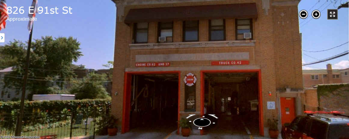
In the 1910s Hungarians settled mainly in Burnside (Bronszajd), also called Triangle because it was bordered on three sides by the shops and tracks of the Illinois Central and Nickel Plate Railroads. Burnside became even more prominent in the 1920s with its numerous Hungarian stores, shops, and restaurants located near the intersection of Cottage Grove and 95th Street running just outside the Triangle. Hungarians, 25 to 40 percent of the residents on some streets, lived alongside people of Ukrainian, Italian, and Polish origin. West Pullman and Roseland also had large Hungarian groups working in the district's mills, railroads, and large factories. In most families women went out to work in the factories to contribute to the family income. Some women stayed at home and made some money by doing sewing jobs. Others earned additional income by taking in boarders.

On the West Side, the factories of the Northwestern Railroad attracted immigrant workers. Although the Hungarians living on Crawford (now Pulaski), Madison, Lake, and Carroll were fewer than three hundred in the 1920s, it was the West Side settlement that became known as Little Hungary. A large Hungarian-owned factory, the Sinko Tool Company, was situated there and employed many skilled Hungarian workers.

Although World War I and the restrictive U.S. immigration laws of the 1920s curbed immigration, Hungarians continued to arrive. The Trianon Treaty had deprived Hungary of two-thirds of its territory, leaving three and a half million Hungarians as an ethnic minority living outside the nation's new borders. Many decided to leave, and Hungarian Americans waged a steady campaign to raise the immigration quota. Ensuing years of chaos, revolution, counter-revolution, extreme nationalism, and anti-Semitism created many political refugees.

Immigrants coming from Hungary between the two wars were predominantly intellectuals and of urban background. They had little in common with the older working-class immigrants and tended to settle around Logan Square and Humboldt Park. On the Near North Side, Hungarians formed scattered enclaves around the edge of the old German community from North Avenue and Wells into Lake View and up Lincoln Avenue. They intermingled with the more prosperous Hungarian-speaking Germans and Jews who ran stores, restaurants, trade companies, law offices, and banks in the region.

Although community building began with the creation of social clubs and mutual benefit societies in 1892, the most important tool of ethnic cohesion was the parish. Hungarians founded the first Protestant church in South Chicago in 1898. In West Town, the Roman Catholic Parish of St. Stephen, King of Hungary, emerged as a major cultural center for Hungarians regardless of their religious affiliation. Hungarian language and cultural traditions were maintained by the Hungarian Cultural and Educational House (1969), which also published the literary periodical Szivárvány. In addition, events such as the annual grape festival helped to sustain Hungarian folk traditions. Women played active roles in the creation of sick-benefit societies. They were also highly visible in the communal and religious groups. The Scout Leaders of the Hungarian Scout Troop Association (1946), which is still active, have mainly been women. They, together with the Women's League of the Evangelical Church, have organized English-language classes for the newly arrived immigrants and Hungarian-language classes for the children of Hungarian Americans.

The post–World War II era brought more political refugees to the United States, with one thousand Hungarians taking up residence in Chicago under the Displaced Persons Acts of 1948 and 1950. After the suppression of the Hungarian Revolution of 1956, thousands of Hungarians, called fifty-sixers, sought refuge in the United States, with many settling in Chicago.

Yet the arrival of new immigrants could not stop the gradual dissolution of the Hungarian neighborhoods. Most Hungarians married outside the Hungarian community, and many South Siders moved to suburbs such as Lansing, Calumet City, and Burnham. On the North Side, the last vestiges remained around Belmont, Clark, and Lincoln Avenues until the 1970s, when most Hungarian American families moved to Skokie, Niles, and Northbrook.

Hungarians have participated in the growth and development of Chicago as entrepreneurs, designers, businessmen, artists, and scholars. László Moholy-Nagy, Marcel Breuer, and Albert Kner, formerly leading figures of the Bauhaus artistic tradition, became successful entrepreneurs by ingeniously combining art design with business. Conductors Sir George Solti and Fritz Reiner helped bring international fame to the Chicago Symphony Orchestra. Since the 1960s, Hungarian immigrants to the United States have been mainly professionals. A considerable number of scholars of Hungarian origin work at Chicago's institutions in medical research, computer science, engineering, and mathematics.

Bibliography
“Hungarian Americans.” In Gale Encyclopedia of Multicultural America, vol. 1, 1995, 692–709.
Fejűs, Zoltán. A Chicagói Magyarok két nemzedéke, 1890–1940. [Two generations of Hungarians in Chicago, 1890–1940]. Summary in English. 1993.
Schaaf, Barbara. “Magyars of the Midwest.” Chicago Tribune Magazine, May 6, 1979.


This is the Fire Station in Burnside on 91st Street that I visited while attending school (1st or 2nd grade at that time) at Perry School.  We were allowed to slide down the poles that still existed at that time.

TCT

http://www.bing.com/maps/default.aspx?encType=1&where1=9130+S+University+Ave%2c+Chicago%2c+IL+60619&cp=41.7285575866699~-87.5967483520508&qpvt=9130+S+University+Ave%2c+chicago%2c+illinois&FORM=MIRE#Y3A9cXluOGhmN3EwNzloJmx2bD0xOCZzdHk9eCZhcHA9NTA4Mg==

This is the corner of 87th Street and Cottage Grove in Burnside, Chicago.

Looking west on 87th.

I believe there used to be a "Cupid Candies" on the left (south west corner) and a "Walgreen's on the right (north west corner).  My mother, Anna Mae Feske worked at both places.  TCT

(Now it looks like a bank on the left and an A&P on the right)  I believe the Walgreens burned down.

http://www.bing.com/maps/default.aspx?encType=1&where1=9130+S+University+Ave%2c+Chicago%2c+IL+60619&cp=41.7285575866699~-87.5967483520508&qpvt=9130+S+University+Ave%2c+chicago%2c+illinois&FORM=MIRE#Y3A9cXluOGhmN3EwNzloJmx2bD0xOCZzdHk9eCZhcHA9NTA4Mg==

This is the :viaduct" that I climbed onto one day, while we still lived with my Grandparents on Ellis Ave. (1.5 blocks away) .  When I look down over the side to look at the road, my dad was driving West on 91st street near Drexel Ave.; scared me to death.  I ran back to the house and got there before he did.  He never mentioned it; I think.

At that time there was a corn field where this house and wooden fence are now.

TCT Jan 2013.

http://www.bing.com/maps/default.aspx?encType=1&where1=9130+S+University+Ave%2c+Chicago%2c+IL+60619&cp=41.7285575866699~-87.5967483520508&qpvt=9130+S+University+Ave%2c+chicago%2c+illinois&FORM=MIRE#Y3A9cXluOGhmN3EwNzloJmx2bD0xOCZzdHk9eCZhcHA9NTA4Mg==


Hit Counter