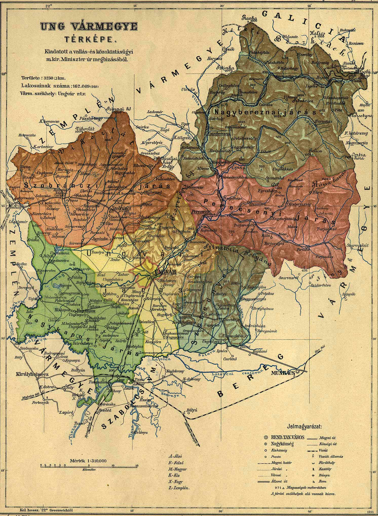
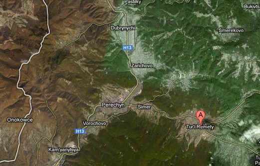
My grandfather and his family are from a town named Velyka
Turycja Ushordska Zapa, Turii Remety. It might also be known as
Nagyturjaszog, which was the Magyar/Hungarian name for the Rusyn
village of Velyka Turycja, sometimes called simply Turycja.
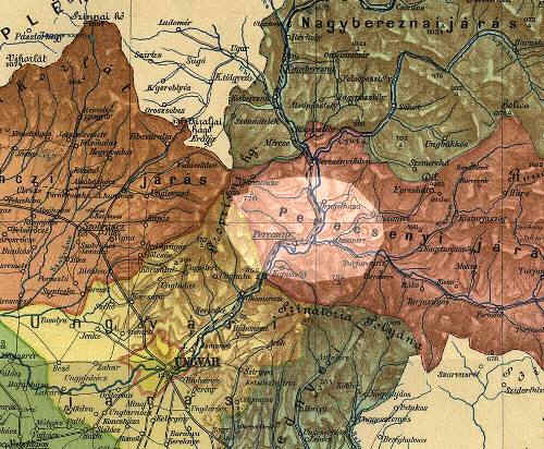
The city of Ungvar, now Uzhorod, is in the yellow area. Just
to the northeast -- colored reddish-brown -- is the district
labeled Perecsenyi after its principle town of Perecsen, today's
Perec'yn, on the west bank of the Ung/Uz' River, across from the
point where the east-to-west flowing Turja River joins it. Five
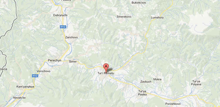
miles east of Perecyn is Turjaremete/ Turji Remety/ Turja Remeta,
at the point where the smaller Turica (=Little Turja) River
joins the Turja from the north. A couple of miles up the Turica
is the village of Nagyturjaszog, which was the Magyar/Hungarian
name for the Rusyn village of Velyka Turycja, sometimes called
simply Turycja.
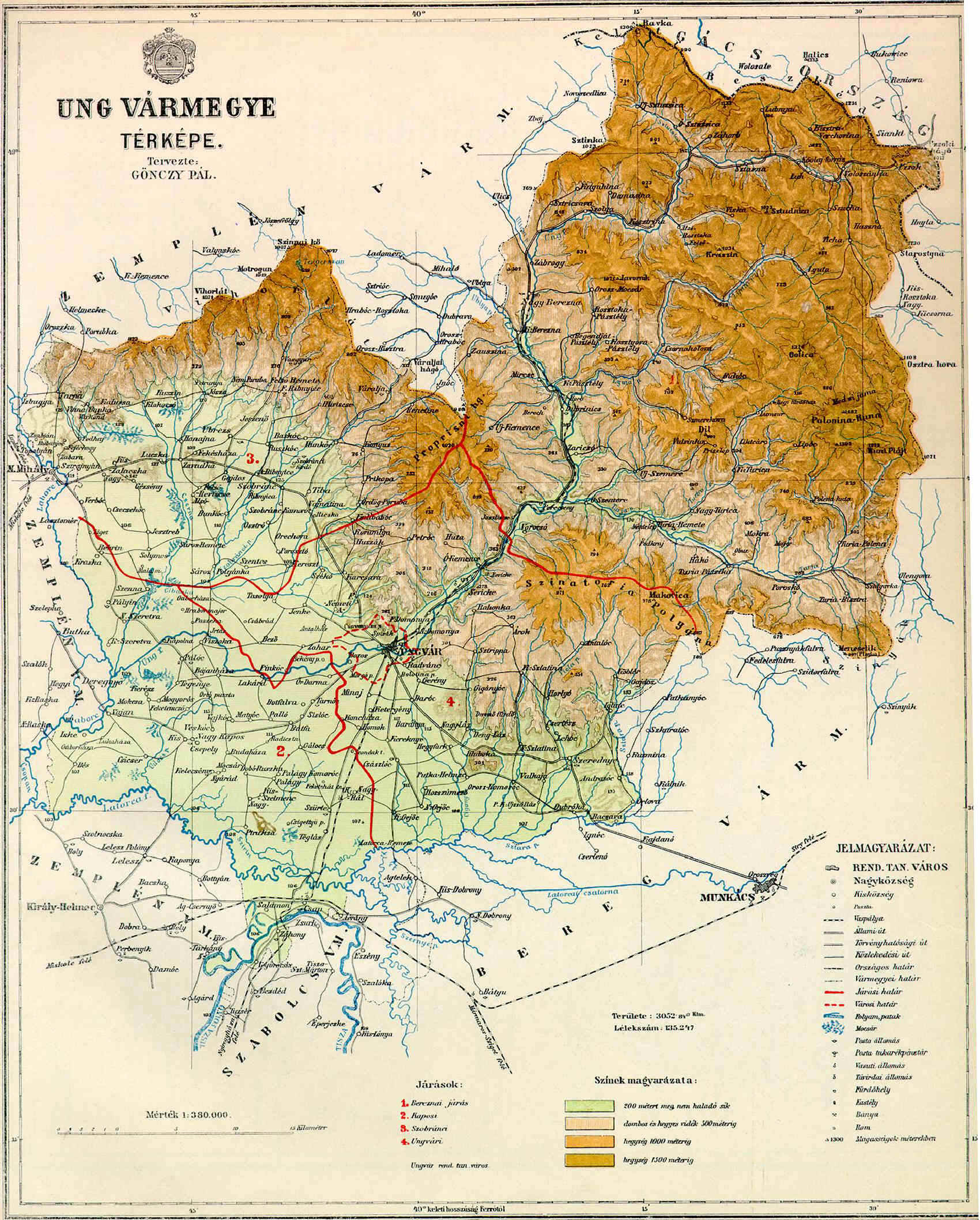
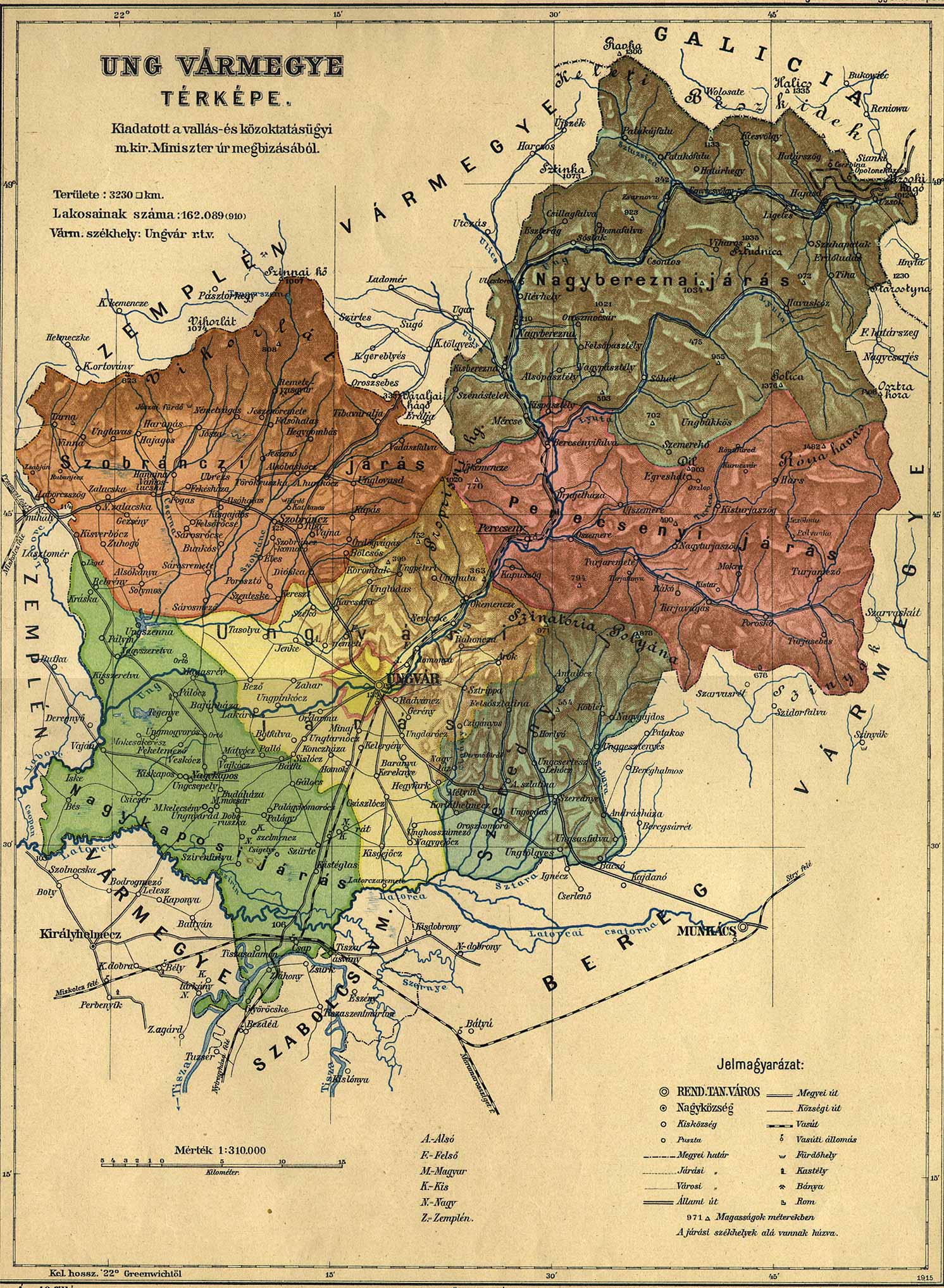
Ung county (in Latin: comitatus Unghvariensis,
in Hungarian: Ung (vár)megye in Slovak also: Užský
komitát/ Užská župa / Užská stolica) is the name of a
historic administrative county (comitatus)
of the Kingdom
of Hungary. Its territory is presently in eastern Slovakia
(1/3) and western Ukraine
(2/3).
Ung county shared borders with the Austrian
crownland Galicia
(currently in Poland
and Ukraine)
and the Hungarian counties Bereg,
Szabolcs
and Zemplén
(Zemplín). It was situated between the Carpathian
Mountains in the north, the rivers Tisza
and Latorica
in the south, and the river Laborec
in the west. The rivers Latorica
and Uzh
(Hungarian: Ung, hence the name of the county) flowed
through the county. Its area was 3230 km² around 1910.
Initially, the capital of the county was the Uzhhorod
Castle, later the town of Uzhhorod
(in Hungarian: Ungvár).
Map of Ung county around 1910
Ung is one of the oldest counties of the Kingdom of Hungary.
In the aftermath of World
War I, most of Ung county became part of newly formed Czechoslovakia,
as recognized by the concerned states in the 1920 Treaty
of Trianon. The town of Záhony
and the village of Győröcske
remained in Hungary
(county Szabolcs-Ung).
Following the provisions of the controversial First
Vienna Award, all but the westernmost part of the county
came under Hungarian control in November 1938. After World
War II, this westernmost part was returned to
Czechoslovakia. The rest (except Záhony and Győröcske)
became part of the Soviet
Union, Ukrainian
SSR, Zakarpattia
Oblast.
Demographics
1900
In 1900, the county had a population of 153,266 people and
was composed of the following linguistic communities[1]:
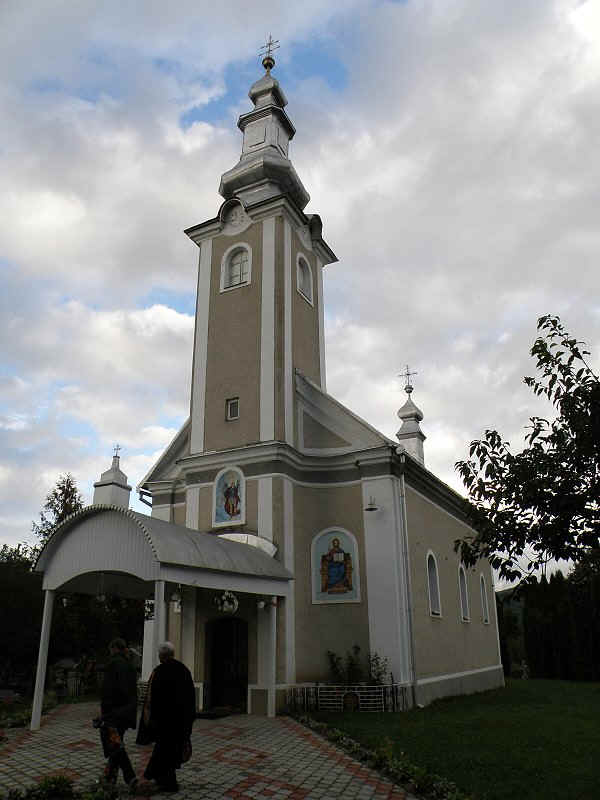
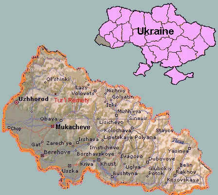
Perechyn (in Hungarian: Perecseny) is a "town type
settlement" in the Perechyn (or Pereein) district of
Transcarpathia Oblast. The settlement has got ~6.600 inhabitants
near all of them Ruthenian. The village was in the Ung (in
Ukrainian Uzh (or Už)) County of the Kingdom of Hungary till
1919/1920 (Czechoslovakian occupation / Treaty of Trianon).
1920-1939 part of Czechoslovakia, in 1939 part of the
short-lived Subcarpathia, in 1939-1944 part of Hungary (after
the Hungarian occupation and annexation). 1946-1992 part of the
Soviet Union and now Ukraine. The settlement is a district seat
near Uzhhorod (20 km north in the Uzh Valley. Istvan Molnar, 26 November 2000
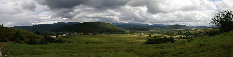
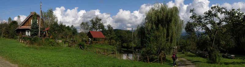
The city of Perechyn is nestled between the
Carpathian Mountains some twenty kilometers north of Uzhgorod.
With a population of around 7000 people, this small city swells
to larger numbers on the weekends when people from neighboring
villages come to shop in this rayon center and during summer
when tourists traverse the lovely mountain road on their way
North to Lviv. There are many different nationalities living in
harmony with one another including Ukrainians, Russians,
Belarusians, Slovakians, and Hungarians.
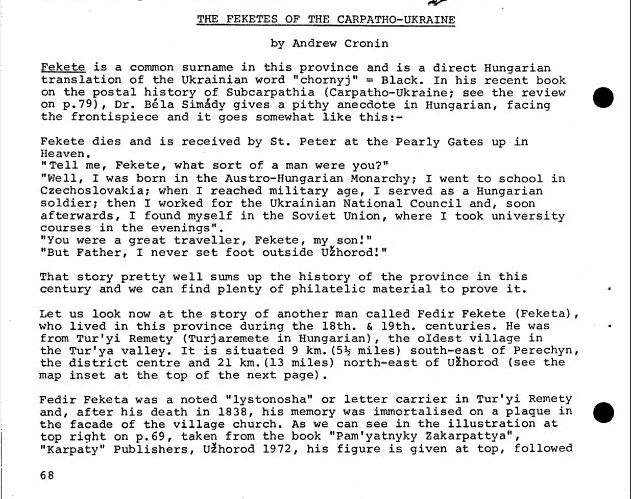
In the main square, is a statue built in honor of Fedor
Feketa who traveled 30 kilometers by foot each week carrying the
mail to villages throughout the region. Legend has it he started
his route, while waiting for a letter from his parents.
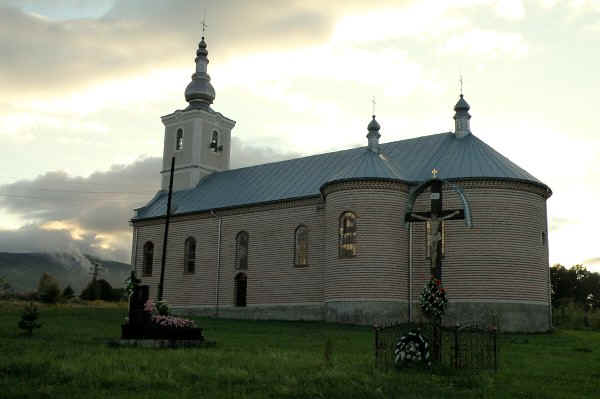
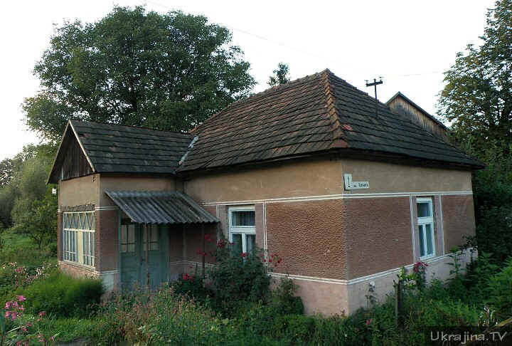
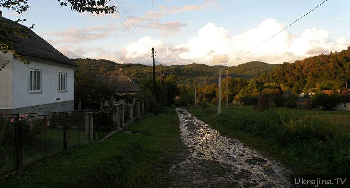
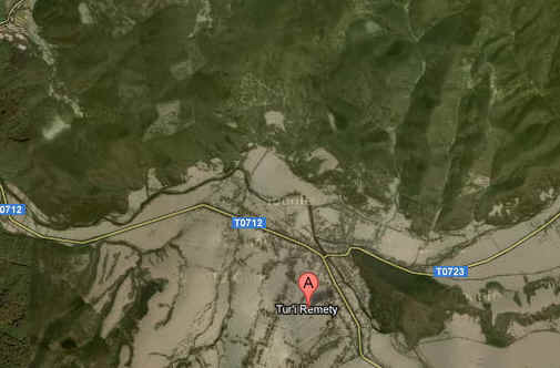
Tur'i
Remety
was part of the Kingdom of Hungary (11th century - 1918 and
1938-1944) with the name of Turjaremete
in Ung megye (county) and Kárpátalja járás
(district), next part of Czechoslovakia (1918-1938) with the
name of Turjanský Remety
in Podkarpatská Rus (Sub-Carpathia), then part of the Ukrainian
Soviet Socialist Republic (1945-1991) with the name of Turyanremety
and, since 1991, known as Tur'i Remety, in the Peretschynskyi rayon
(district) of Zakarpats'ka oblast (county) of Ukraine.
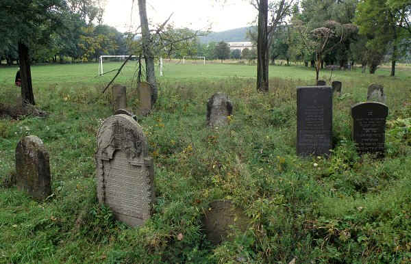
Other spellings/names for Tur'i Remety are Turaremete, Turja
Remete, Turjí Remety and Remetoturia. In Yiddish, Turi-Remety
is known as Remit
.
Turi-Remety is located about 19 miles NNW of Mukacheve (Munkács),
15 miles ENE of Uzhhorod (Ungvár).


