|
Mary_Weaver_Thornton m 1816
| |
|
John Thornton |
|
(1798 - 1821?(22?)) |
|
History
in Words and Photos |
 |
02/24/13
|
|
|
|
|
THORNTON
GENEALOGY PROJECT 2011
HOME
PAGE
|
|
|
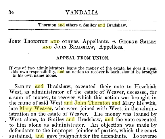
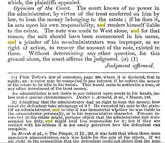
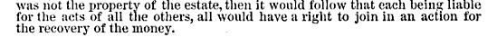
Reports of cases at common
law and in chancery, argued and ..., Volume 1
By Illinois. Supreme Court
John Thornton, estate of Mary Weaver
family?
http://books.google.com/books?id=vuwNAQAAMAAJ&pg=PA34&lpg=PA34&dq=%22John+Thornton%22+and+%22Mary+Weaver%22&source=bl&ots=Y0iOnKKaPE&sig=2bz138PI_lVB9jcvr2IiSIJ789M&hl=en&ei=NBuGTs7bGOOQsQLD0uWUDw&sa=X&oi=book_result&ct=result&resnum=4&ved=0CC4Q6AEwAw#v=onepage&q=%22John%20Thornton%22%20and%20%22Mary%20Weaver%22&f=false
|

|
| http://www.jenforum.org/thornton/messages/3508.html
|
Hi margaret John died in 1822. I don't know his age but in
1818 he was a minor. He went to court and it said I was a minor.
He married a women named mary weaver who had 3 small children. I
have a copy of a loan he made in 1822 just be for he died . and
a copy of his probate. I can't fine his grave. He operated a
gramshot in Jonesboro Ill. at the time of his death. He sold
land to Jonesboro . but thats all I know. My Great Grand fathers
name was John logan Thornton He was born in 1862. Hope it helps
Gary
|
| Jonesboro, Illinois
http://en.wikipedia.org/wiki/Jonesboro,_Illinois
|
Jonesboro is a city in Union
County, Illinois,
United
States. The population was 1,853 at the 2000 census. It is the
county
seat of Union
County,[1]
and was the location of the third of the Lincoln-Douglas
debates, on 15 Sept, 1858.
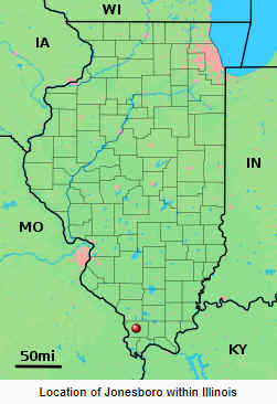
Also, Jonesboro was the end point in the
"Trail of Tears" of Indian displacement to the west! |

http://dnr.state.il.us/lands/landmgt/parks/r5/trltears.htm
|
History
The area was used
extensively by prehistoric Native Americans. Individuals and small
groups hunted game or gathered nuts within the Ozarks, but
established their settlements closer to the Mississippi River or
Clear Creek. Chert was mined (for making tools) at Iron Mountain,
east of the Forest.
As settlers of European
descent entered (around 1803), Native Americans were pushed south
and west. In 1838-39 the Cherokee, Creek, and Chickasaw nations
were forced by the U.S. Army to move from the southeast to
reservations in Oklahoma Territory. They over-wintered at
makeshift camps 4 miles south of the Forest's southern boundary.
Bitter cold and starvation claimed hundreds of lives. The cruel
trek came to be known as the "Trail of Tears." The State
Forest's name memorializes the tragic event.
Trail of Tears, one of
Illinois' state forests, is situated in western Union County, five
miles northwest of Jonesboro and 20 miles south of
Murphysboro. Just over 5,000 acres are within the State Forest.
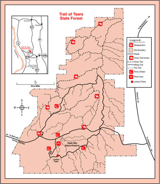
3240 State Forest Road
Jonesboro, IL 62952
618.833.4910 |
| Union County, Illinois
http://en.wikipedia.org/wiki/Union_County,_Illinois
.jpg?m=1314458832) |
Union County was formed out of Johnson
County in 1818, the same year Illinois joined the Union.
-
For its first year of existence, Union County included
an area of unorganized territory temporarily attached to
it.[3]
-
In 1819, the additional territory became Alexander
County, reducing Union to its current borders.
|
|
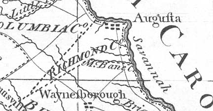
| http://georgiainfo.galileo.usg.edu/histcountymaps/richmondhistmaps.htm
|
Richmond
County
|
 |
The land that would form Richmond County was ceded to
the English by the Creeks in the Treaty
of Savannah on May 21, 1733, confirmed and expanded
by agreements of 1735 and 1736. By an act
of March 15, 1758, the colonial legislature created
seven parishes. The area of present-day Richmond County
primarily fell within St. Paul Parish (see
map). With the outbreak of the American Revolution,
Whig forces took control of government in Georgia. On
Feb. 5, 1777, they adopted the state's first
constitution -- the Constitution of 1777. Art.
IV of that document transformed the existing
colonial parishes into seven counties, with Indian ceded
lands forming an eighth county. Richmond County, which
was second on the list and thus is considered Georgia's
second county, consisted of all of St. Paul Parish. The
county was named for the third Duke of Richmond, Charles
Lenox (1735-1806), who was British secretary of state
and sympathetic to the cause of the American colonies.
In 1790, Columbia County was created from the
northern half of Richmond County (Ga. Laws 1790, p. 9).
-
-
-
-
- 1777
-
- 1796
-
- 1822
-
- 1823
-
- 1830
|
 1796 1796
|
|
http://georgiainfo.galileo.usg.edu/histcountymaps/ga1796map.htm
|
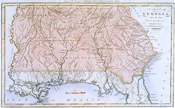 Map
of Georgia, 1796 Map
of Georgia, 1796 |
|
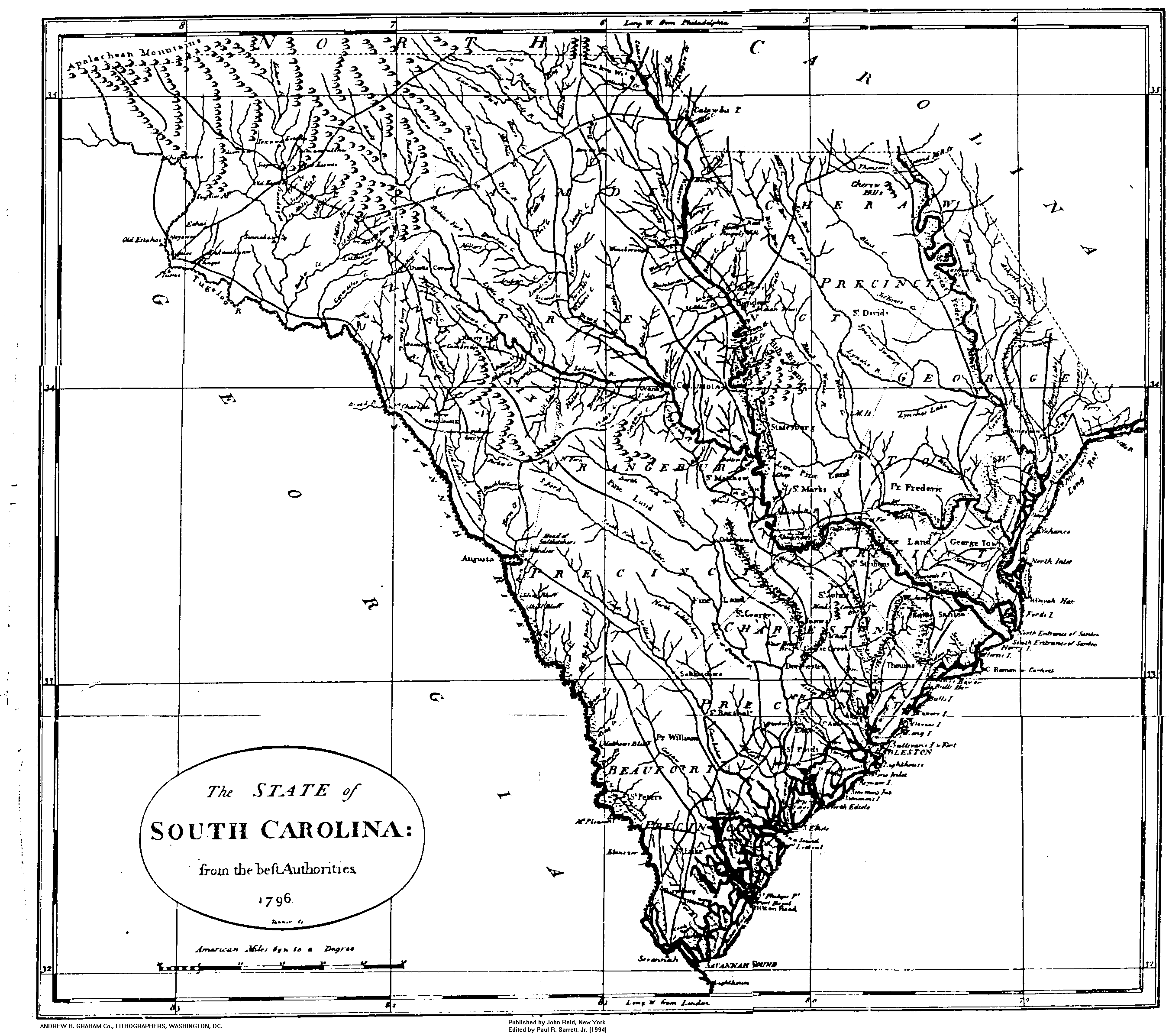
http://www.usgwarchives.net/sc/maps/sc_1796.gif
|
 |
|
http://georgiainfo.galileo.usg.edu/gamaps/ga1751map.htm
|
 1751
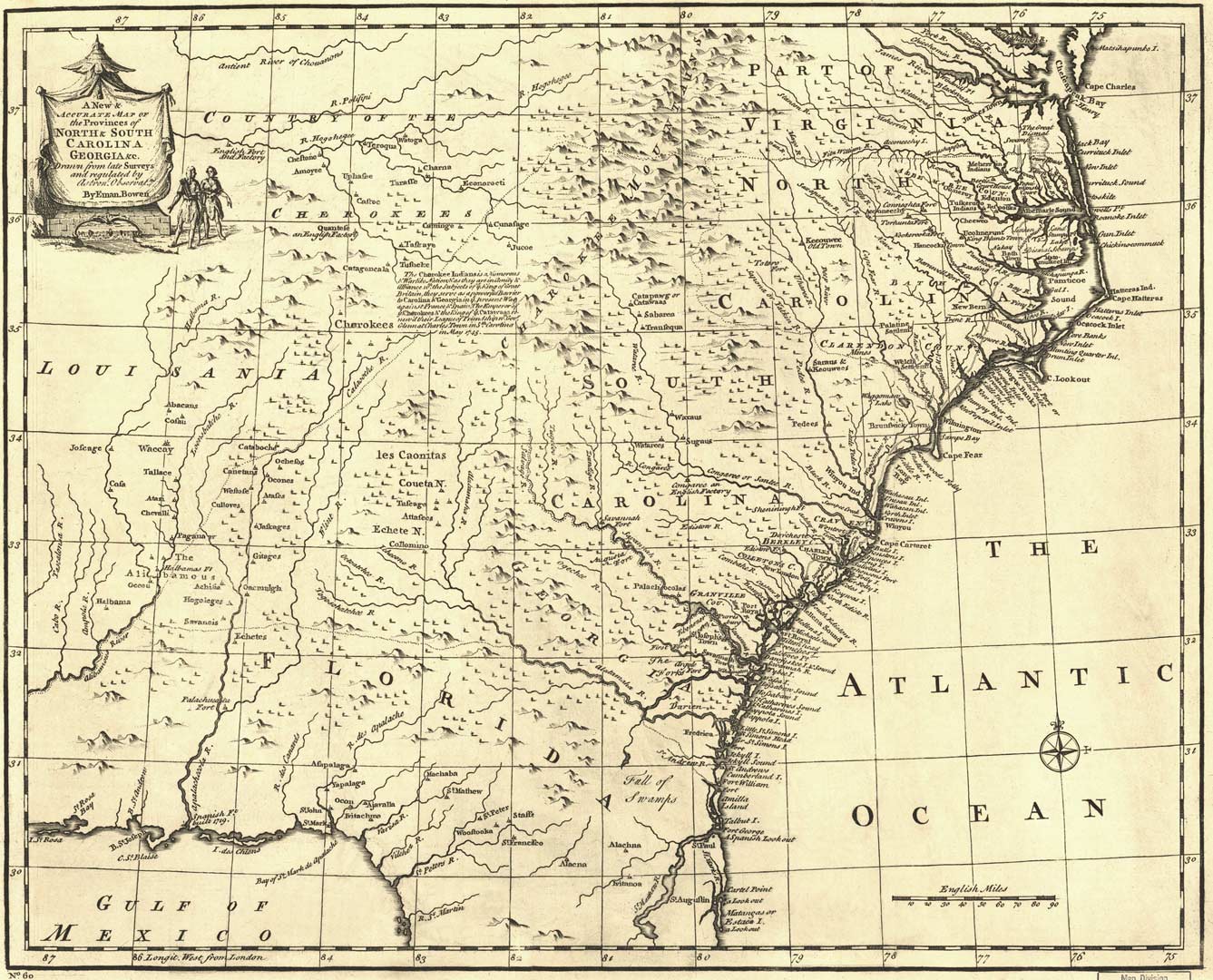
Map of the Carolinas and Georgia 1751
Map of the Carolinas and Georgia |
| http://www.tngenweb.org/cessions/ |
 Includes
maps of US Southeast Includes
maps of US Southeast |
| |
|
|
| |

|


